
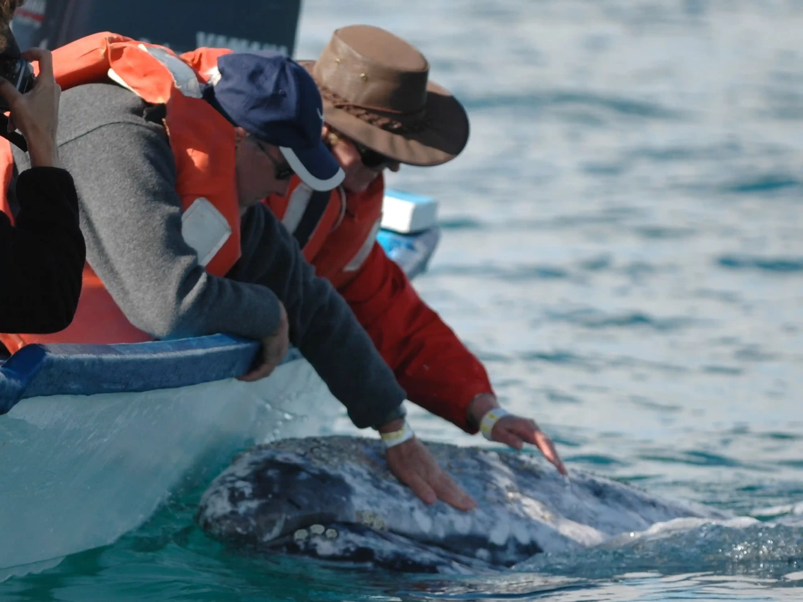
Guerrero Negro, the gateway to Laguna Ojo de Liebre, sits roughly 700 kilometres south of Tijuana on Mexico Federal Highway 1. Most guests reach it one of three ways: driving down the peninsula over one or two days, taking the overnight bus from Tijuana, or flying into Loreto and driving north.
There is no direct international flight. That is genuinely part of why the lagoon stays as it is: more than 60 percent of the world’s gray whale population gathers here each winter, in a place that takes some effort to reach.
This guide covers each route honestly, including how long it really takes, what the paperwork requires, and when in the season to come.
Quick answers
- Nearest town: Guerrero Negro, on the Baja California and Baja California Sur state line
- Distance from Tijuana: approximately 700 km
- Driving time from the border: 11 to 13 hours, usually split across two days
- Bus from Tijuana: around 12.5 hours, roughly $80 to $130
- Nearest commercial airport with US flights: Loreto
- Season: mid-December to end of April, with February and March the peak
- Required paperwork: valid passport and an FMM tourist card for every traveller
- Vehicle import permit: not required on the Baja peninsula
The four routes, compared
| Route | Time | Approximate cost | Best for |
| Drive from San Diego border | 11 to 13 hours, best split over 2 days | Fuel, insurance, one night’s lodging | Travellers wanting flexibility and the peninsula itself |
| Bus from Tijuana | About 12.5 hours, overnight | $80 to $130 | Solo travellers, budget-conscious, no driving |
| Fly to Loreto, then drive | Flight plus roughly 5 hours driving | Airfare plus car hire | Those short on time who still want a vehicle |
| Regional flight to Guerrero Negro | Limited schedule | Varies | Travellers already in Baja with flexible dates |
Most of our guests drive or take the bus. We can advise on the option that suits your dates once we know where you are travelling from, so raise it when you get in touch.
Driving Mexico Highway 1
This is the classic approach and, for many guests, part of the trip rather than an obstacle to it. Mex 1 runs the length of the peninsula through desert, boojum forest and coastline that most visitors never otherwise see.
The route: I-5 south to San Diego, cross the border at Tijuana or Tecate, then Highway 1 south through Ensenada, San Quintín and El Rosario, across the central desert to Guerrero Negro.
What to know before you drive
- Split it into two days. Attempting 700 km in one push, after a border crossing, makes for a hard arrival. San Quintín and Cataviña are common overnight stops.
- Do not drive Mex 1 at night. The road is unlit, largely without shoulders in the central section, and livestock stray onto it. This is the single most repeated piece of advice from experienced Baja drivers and it is worth following.
- Mexican auto insurance is mandatory. US and Canadian policies do not provide valid coverage in Mexico. Buy a policy before crossing.
- You do not need a Temporary Vehicle Import Permit on the Baja peninsula, unlike mainland Mexico. You do need it if you plan to ferry across to the mainland.
- Fuel where you can, not where you must. Pemex stations are reliable but spacing through the central desert is wide. Refuel at half a tank rather than a quarter.
- Expect military checkpoints. These are routine on Mex 1, brief, and generally courteous. Have your passport and FMM accessible.
- The state line brings a time change. Guerrero Negro sits right on the Baja California and Baja California Sur border, and the two states observe different time. Confirm the current position before you set your arrival time, and build in a margin.
Realistic driving segments
| Leg | Approximate distance | Approximate driving time |
| Border to Ensenada | 110 km | 1.5 to 2 hours |
| Ensenada to San Quintín | 190 km | 2.5 to 3 hours |
| San Quintín to Cataviña | 230 km | 3 hours |
| Cataviña to Guerrero Negro | 230 km | 3 hours |
Add time for the border crossing, which varies considerably by day and hour.
Taking the bus
Autobuses ABC runs services from Tijuana Central Bus Terminal to Guerrero Negro twice daily. The journey takes around 12.5 hours and fares run roughly $80 to $130.
This is a genuinely good option, and one that solo travellers in particular tend to underuse. The buses are comfortable long-distance coaches, the overnight service means you arrive in the morning, and it removes both the night-driving problem and the need for insurance and a vehicle.
The main consideration is that you arrive without transport, so confirm transfer arrangements with us in advance.
Flying
Via Loreto. Loreto is the nearest commercial airport served by flights from the United States. From there it is roughly a five hour drive north to Guerrero Negro. This suits travellers with limited time who still want a car.
Loreto is also worth considering as a destination in its own right rather than only a transit point. The Sea of Cortez side offers entirely different marine wildlife, which we cover on our whale watching in Loreto and blue whale expeditions pages. Some guests combine the two coasts in a single trip.
Regional flights. Aeroservicios Guerrero operates a small regional service from Ensenada to Guerrero Negro on a limited weekly schedule, routing via Isla de Cedros. Schedules on regional carriers change, so verify directly before planning around it.
Private and charter. Guerrero Negro has an airstrip. Guests arriving by private aircraft should contact us in advance so we can coordinate ground arrangements.
When to come
The gray whale season at Ojo de Liebre officially runs from mid-December to the end of April. Within that window, conditions differ meaningfully.
| Period | What is happening | Consideration |
| Mid-December to mid-January | First arrivals, numbers building | Fewer whales, quieter lagoon |
| Late January | Numbers rising, first calves | Good balance of activity and space |
| February to March | Peak. Highest numbers, mothers with calves | The strongest window for close encounters |
| April | Numbers declining as whales depart | Later calves still present, fewer boats |
February and March are when whale numbers and mother-and-calf activity are at their height. Calves born in the lagoon are curious, and it is the calves in particular that approach boats of their own accord.
If your dates are flexible, aim for that peak window. If they are not, the shoulder periods still deliver, with fewer people on the water. Our 2027 schedule sets out the specific trip dates and pricing.
Paperwork
Passport. Required for all travellers entering Mexico.
FMM tourist card. Required for every person entering Mexico, including children, regardless of how brief the visit. It can be issued for up to 180 days. Obtain it at the border crossing or on arrival at the airport, keep it with you throughout, and retain it for departure. Travellers who assume a short Baja trip does not require one are the ones who encounter problems.
Mexican auto insurance. Mandatory if driving your own vehicle, as covered above.
Vehicle permit. Not required for the Baja peninsula.
Requirements can change, so confirm the current position with official sources before you travel. We will send full pre-trip documentation once your booking is confirmed.
Building your itinerary
A realistic structure for a driving guest:
- Day one. Cross the border in the morning, drive to San Quintín or Cataviña, overnight there.
- Day two. Continue to Guerrero Negro, arriving with daylight to spare. Transfer to camp.
- Days three onward. Whale watching from camp, with boat trips each day.
- Final day. Depart, either retracing north or continuing south into Baja California Sur.
For bus and flight arrivals the first day collapses, but the principle holds: arrive with daylight, and do not schedule your first boat trip for the day you travel.
Guests frequently tell us afterwards that they wished they had built in an extra day at the end. The peninsula rewards it, and our Baja California guide covers what else is worth seeing.
Why the journey is part of it
It would be easier to sell this trip if there were a direct flight. There is not, and that shapes what you find when you arrive.
Laguna Ojo de Liebre sits inside the Vizcaíno Biosphere Reserve, and its protection is why the whales return in the numbers they do. The same remoteness that makes the journey long is what keeps the lagoon calm, sheltered and suitable for mothers raising calves. It is also why encounters here are what they are, with whales approaching boats rather than being pursued by them. More on how that works in practice is on our responsible whale watching page.
Twenty-five years of running this camp has taught us that the guests who plan the travel properly, rather than compressing it, have the better trip.
Frequently asked questions
How do I get to Laguna Ojo de Liebre?
Travel to Guerrero Negro, roughly 700 km south of Tijuana on Mexico Highway 1. Most visitors drive over two days, take the twice-daily bus from Tijuana, or fly into Loreto and drive about five hours north. There is no direct international flight to Guerrero Negro.
How long does it take to drive from the US border?
Between 11 and 13 hours of driving, which is best split across two days with an overnight stop in San Quintín or Cataviña. Driving Mex 1 after dark is strongly discouraged because the road is unlit and livestock stray onto it.
Is there an airport at Guerrero Negro?
There is an airstrip served by limited regional flights, including a service from Ensenada via Isla de Cedros. It is not served by international carriers. Loreto is the nearest commercial airport with flights from the United States.
Do I need a tourist card for a short trip to Baja?
Yes. An FMM is required for every person entering Mexico, including children, regardless of trip length or destination within the country. Keep it with you and retain it for departure.
Do I need a vehicle permit to drive in Baja?
No. A Temporary Vehicle Import Permit is not required on the Baja peninsula. It is required if you ferry your vehicle to mainland Mexico. Mexican auto insurance, however, is mandatory, as US and Canadian policies do not provide valid cover.
Is it safe to drive in Baja?
Baja Highway 1 is regularly driven by visitors. The main practical risks are night driving, livestock on the road and long gaps between fuel stations rather than anything unusual. Drive in daylight, refuel early and allow more time than a map suggests.
When is the best time to see gray whales at Ojo de Liebre?
February and March, when whale numbers and mother-and-calf activity peak. The full season runs mid-December to the end of April, and the shoulder periods offer quieter conditions with fewer boats.
Can I combine this with whale watching elsewhere in Baja?
Yes, and guests flying via Loreto often do. The Sea of Cortez offers different species entirely, including blue whales. See our Loreto and blue whale expedition pages.
Do I need a car once I am at camp?
No. Once you arrive at Guerrero Negro, camp transfers and daily boat trips are arranged. A vehicle is useful only for exploring the peninsula before or after your stay.
I am travelling alone. Is that workable?
Yes, and the bus route suits solo travellers particularly well. We do not charge a single supplement, so travelling alone costs you nothing extra.
Planning your 2027 trip
Once you know roughly when you want to travel, we can advise on the route that fits your dates and where you are coming from, and confirm what transfers we can arrange from Guerrero Negro.
View the 2027 schedule and pricing, read about the camp itself, or get in touch. You can also call us on +1 (626) 512-0877.
Gray Whale Camp is operated by Baja Jones Adventures, which has run this camp on Laguna Ojo de Liebre for more than 25 years. Read about Keith Jones, the whale species and wildlife of the reserve, or browse expedition stories from past seasons.